The Future of Wildfire Suppression: How Drones and Artificial Intelligence are Revolutionizing Forest Fire Management

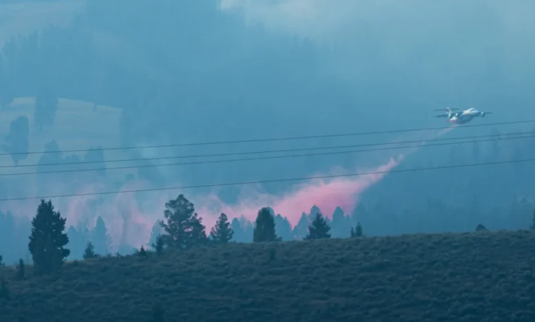
The landscape of wildfire suppression is undergoing a profound transformation as federal agencies, led by the U.S. Forest Service, increasingly integrate unmanned aerial systems (UAS) and artificial intelligence into their emergency response protocols. As seen during the prolonged Sand Creek Fire in southwestern Montana, which began in early August 2026, the reliance on human personnel to manually scout smoldering embers in hazardous, high-altitude terrain is rapidly being supplanted by robotic precision. This shift is not merely a matter of convenience; it represents a fundamental change in how fire management professionals perceive risk, data collection, and operational efficiency in an era defined by more frequent and intense wildfire seasons.
The Sand Creek Fire and the Evolution of Tactical Response
The Sand Creek Fire, burning since the first week of August 2026, served as a primary proving ground for the deployment of drone technology in active incident zones. The rugged, mountainous geography of southwestern Montana presented a two-fold challenge: the physical exhaustion of ground crews traversing steep, unstable slopes and the persistent danger posed by fire-weakened "snags"—standing dead trees that can collapse without warning.
By deploying drones equipped with thermal-infrared sensors, incident commanders were able to identify "hotspots"—pockets of residual heat that could potentially reignite into a full-scale flare-up—without placing firefighters in the line of fire. Historically, finding these smoldering zones required "mop-up" operations, where crews physically searched every square foot of a burn perimeter. This process is time-consuming, physically taxing, and inherently dangerous. The transition to aerial scouting allows for a more surgical approach, where personnel are directed only to confirmed areas of concern, significantly reducing their exposure to the unpredictable environment of a post-containment burn site.
A Chronology of Technological Integration in Wildland Firefighting
The adoption of autonomous technology by federal agencies has been an iterative process, accelerating over the past decade. The integration of drones into the National Wildfire Coordinating Group (NWCG) standards reflects the growing maturity of these tools.
- 2015–2018: Initial pilot programs focused on basic mapping and situational awareness. Federal agencies began testing the use of drones for aerial ignition—dropping small, incendiary spheres to create "backfires" that consume fuel before the main fire arrives.
- 2019–2022: The Forest Service standardized training modules for drone pilots, establishing specific career tracks such as UAS module leaders and data specialists.
- 2023–2025: Research shifted toward ground-based robotics. In June 2026, the Forest Service conducted high-stress field tests in Georgia, evaluating autonomous ground vehicles designed to traverse rocky, uneven terrain while carrying heavy payloads.
- 2026–Present: The integration of real-time AI modeling, as demonstrated by academic research from the University of Idaho, marks the current frontier of fire management, moving from simple observation to predictive analysis.
Supporting Data and Technical Capability
The technical specifications of the equipment currently under evaluation are impressive. The autonomous ground vehicles tested by the Forest Service are engineered to carry up to 800 pounds of equipment, including specialized fire hose packs, chainsaws, medical triage kits, and water canisters. These units are designed to operate in environments where traditional ATVs or heavy machinery would fail, such as areas with high-density undergrowth or extreme vertical grades.
In the air, the utility of drones is equally significant. Unlike traditional manned aircraft—such as the large tankers used to drop retardant—drones are not limited by the same visibility or light requirements. When heavy smoke obscures the view for human pilots, or when turbulence makes manned flight hazardous, thermal-imaging drones can continue to map the fire perimeter. This provides a continuous data stream, ensuring that incident commanders have a near-real-time "Common Operating Picture" (COP).
Official Responses and Strategic Shifts
Meredith Hollowell, a Forest Service press officer, emphasized that the agency views these tools as force multipliers rather than replacements for human expertise. "Drones are now a critical tool in federal wildfire response," Hollowell stated. "They provide the real-time imagery necessary for tactical decisions that keep our firefighters safer while increasing the speed at which we can reach containment objectives."
The Federal Aviation Administration (FAA) has also streamlined the process for granting temporary flight restrictions (TFRs) over wildfire zones, recognizing that the proliferation of hobbyist drones can pose a significant mid-air collision risk to firefighting aircraft. The collaboration between the FAA and the Forest Service ensures that authorized government drones can operate in restricted airspace, providing a protected, data-rich environment that enhances overall incident safety.
The Rise of AI and Predictive Modeling
Perhaps the most significant development in the field is the intersection of robotics and machine learning. Phinehas Lampman, a researcher at the University of Idaho, has pushed the boundaries of this field by training machine learning models on thermal-infrared data collected by drones.
In a study published in the International Journal of Wildland Fire, Lampman demonstrated that by feeding drone-collected data—specifically measurements of fireline intensity and radiative power—into an AI model, the system could produce accurate, short-term predictions of fire spread rates. While current field practice still relies heavily on the intuition and experience of veteran fire managers, the potential to integrate these AI-driven "decision support tools" is immense.
The goal is not to automate the fire management process entirely, but to provide commanders with a quantitative edge. As Lampman noted, experienced incident commanders have long used their "gut feeling" to predict fire movement based on years of observing terrain and wind patterns. By digitizing this experience through AI, the agency can ensure that the next generation of firefighters has access to a broader, more reliable set of data points, even when visibility is poor or the fire behavior is anomalous.
Broader Implications for Public Safety and Ecology
The implications of this technological revolution extend beyond the fire line. Researchers like Leda Kobziar, a professor of wildland fire science at the University of Idaho, are exploring how drone-gathered data can be used to model smoke dispersion. Understanding the relationship between fire intensity and the chemical composition of smoke—including the types of smoke-borne microbes and fine particulate matter—is essential for public health agencies.
By analyzing the data from drones, officials can provide more accurate, localized warnings to downwind communities, potentially saving lives and reducing the long-term respiratory impacts of wildfire smoke. This data-driven approach also allows for better management of prescribed burns, which are essential for ecosystem health but often face public opposition due to the resulting smoke. If researchers can accurately predict and mitigate smoke impacts using AI, it could increase public support for these vital preventative practices.
The Path Forward
Despite the promise, the technology remains in the proof-of-concept stage for many applications. Routine, widespread deployment of autonomous ground vehicles is still years away, and AI-driven fire behavior prediction is not yet a replacement for traditional methods. However, the trajectory is clear: the fire service is moving toward a highly digitized, semi-autonomous future.
As the climate continues to change, leading to longer, more volatile fire seasons, the pressure to adopt these technologies will only increase. The integration of drones, AI, and robotics is not a luxury, but a necessary evolution to meet the growing challenge of wildland fire. By reducing the reliance on human labor for the most dangerous tasks—such as scouting in heavy smoke or navigating steep, burning terrain—the Forest Service is not only improving its efficiency but is also taking a necessary step toward preserving the safety and mental well-being of the professionals who stand on the front lines of our nation’s forests. As these technologies continue to mature, they will fundamentally redefine the relationship between humans, machines, and the natural elements they are tasked to protect.