
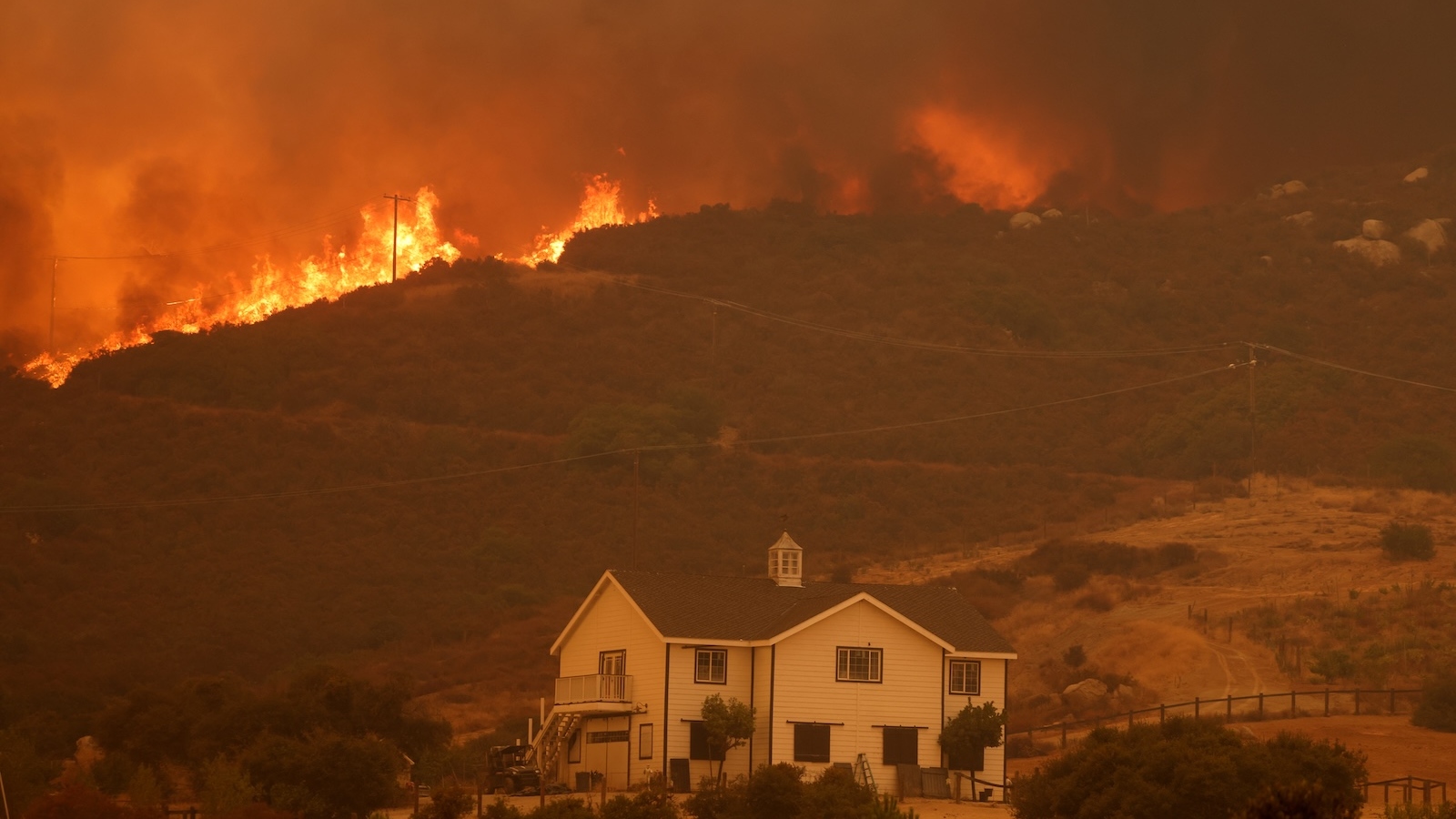
The Silent Crisis of Sinking Shores and Rising Seas A New Reality for Coastal Megacities
The global understanding of coastal vulnerability is undergoing a fundamental and alarming shift. For decades, climate models have provided a roadmap for how rising temperatures would melt polar ice and expand the oceans, leading to a steady, predictable increase in sea levels. However, two landmark studies recently published in the journal Nature have revealed that these projections were built on a precarious foundation. Not only are the world’s oceans significantly higher than previously estimated, but the land in many of the world’s most populous regions is sinking at a rate that far outpaces the rising tides. This "double whammy" of environmental pressure suggests that the timeline for catastrophic flooding in coastal megacities has been moved up by decades, placing tens of millions more people at immediate risk.
The Baseline Discrepancy: Why Current Models Failed
The first pillar of this new scientific consensus comes from a groundbreaking analysis conducted by Katharina Seeger and Philip Minderhoud, geographers at Wageningen University & Research in the Netherlands. Their research identifies a massive "methodological blind spot" in how sea levels have been calculated for the better part of the last century. Traditionally, scientists have relied on mathematical models of the "geoid"—a theoretical shape of the Earth based on rotation and gravity—to estimate sea levels. These models assume a calm, uniform ocean, effectively ignoring the chaotic reality of ocean dynamics.
By analyzing actual data from 385 tidal gauges around the world, Seeger and Minderhoud discovered that real-world sea levels are, on average, nearly one foot (9.4 to 10.6 inches) higher than the geoid-based estimates used in the majority of peer-reviewed literature and reports by the Intergovernmental Panel on Climate Change (IPCC). This discrepancy is not a minor statistical error; it exceeds the total global sea level rise recorded since the beginning of the 20th century.
The reason this error persisted for so long is largely geographical. Geoid models are most accurate in Europe and the Eastern Seaboard of North America, where the bulk of climate research has historically been centered. In the Global South, however, where ocean currents are stronger and prevailing winds pile water against shorelines more aggressively, the models fail significantly. In parts of Southeast Asia, the researchers found that actual tides are three feet or more higher than what mathematical modeling had predicted.
The Sinking Land: A High-Resolution Crisis
While the oceans are higher than we thought, the land beneath our feet is also failing. The second study, led by Leonard Ohenhen, an Earth system scientist at the University of California, Irvine, utilized satellite-mounted radar to create high-resolution 3D maps of 40 of the world’s largest river deltas. His findings provide a stark contrast to previous, cruder estimates of land subsidence.
Subsidence—the sinking of the Earth’s surface—is a natural process in deltas, but it is being accelerated to dangerous levels by human activity. Ohenhen found that more than half of the deltas studied are sinking, and in 18 specific cases, the land is subsiding faster than the sea is rising. In some regions, this effectively multiplies the local rate of sea-level rise by a factor of ten.
The primary culprit is the extraction of groundwater. As growing coastal populations pump water from underground aquifers to supply homes, industry, and agriculture, the sediment layers above compress and collapse, causing the surface to drop. This is compounded by the construction of upstream dams and levees, which trap the sediment that would naturally replenish deltas and keep them above sea level.
A Chronology of Coastal Vulnerability
To understand the gravity of these findings, it is necessary to look at the timeline of how coastal risk assessment has evolved:
- 1920–1960: Rapid industrialization in cities like Tokyo leads to massive groundwater pumping, causing parts of the city to sink by up to 15 feet.
- 1960s–1970s: The construction of the High Aswan Dam in Egypt and various dams on the Yangtze and Yellow Rivers in China begins to starve major deltas of sediment.
- 1990s–2000s: Early IPCC reports focus primarily on global mean sea level rise driven by thermal expansion and glacial melt, using geoid models as the baseline.
- 2005: Hurricane Katrina exposes the extreme vulnerability of New Orleans, a city where subsidence and levee construction had already placed much of the population below sea level.
- 2019: The Indonesian government, facing the reality that North Jakarta has sunk 13 feet in 50 years, officially announces plans to move its capital to East Kalimantan on the island of Borneo.
- 2024–2025: The publication of the Seeger-Minderhoud and Ohenhen studies provides the first high-resolution, global data set confirming that both the sea level baseline and subsidence rates have been systematically underestimated.
Supporting Data: The Human and Geographic Toll
The implications of these revised figures are staggering. The Seeger-Minderhoud study concludes that approximately 80 million people are currently living on land that is technically below sea level—nearly double the previous estimates. If global sea levels rise by another 3.3 feet (one meter), the corrected calculations suggest that 37% more land area and 68% more people will be at risk than previously thought. This additional area of risk is roughly the size of the United Kingdom and is home to 132 million people.
Specific regional data highlights the severity of the crisis:
- The Nile Delta, Egypt: Home to two-thirds of Egypt’s farmland, it is losing coastline at a rate of 300 feet per year due to a combination of sediment loss and groundwater pumping.
- The Yellow River Delta, China: Subsiding up to 10 times faster than the projected rise of the Yellow Sea.
- The Mississippi Delta, USA: Has lost 1,900 square miles of land over the last century and continues to sink by an average of 2 inches annually.
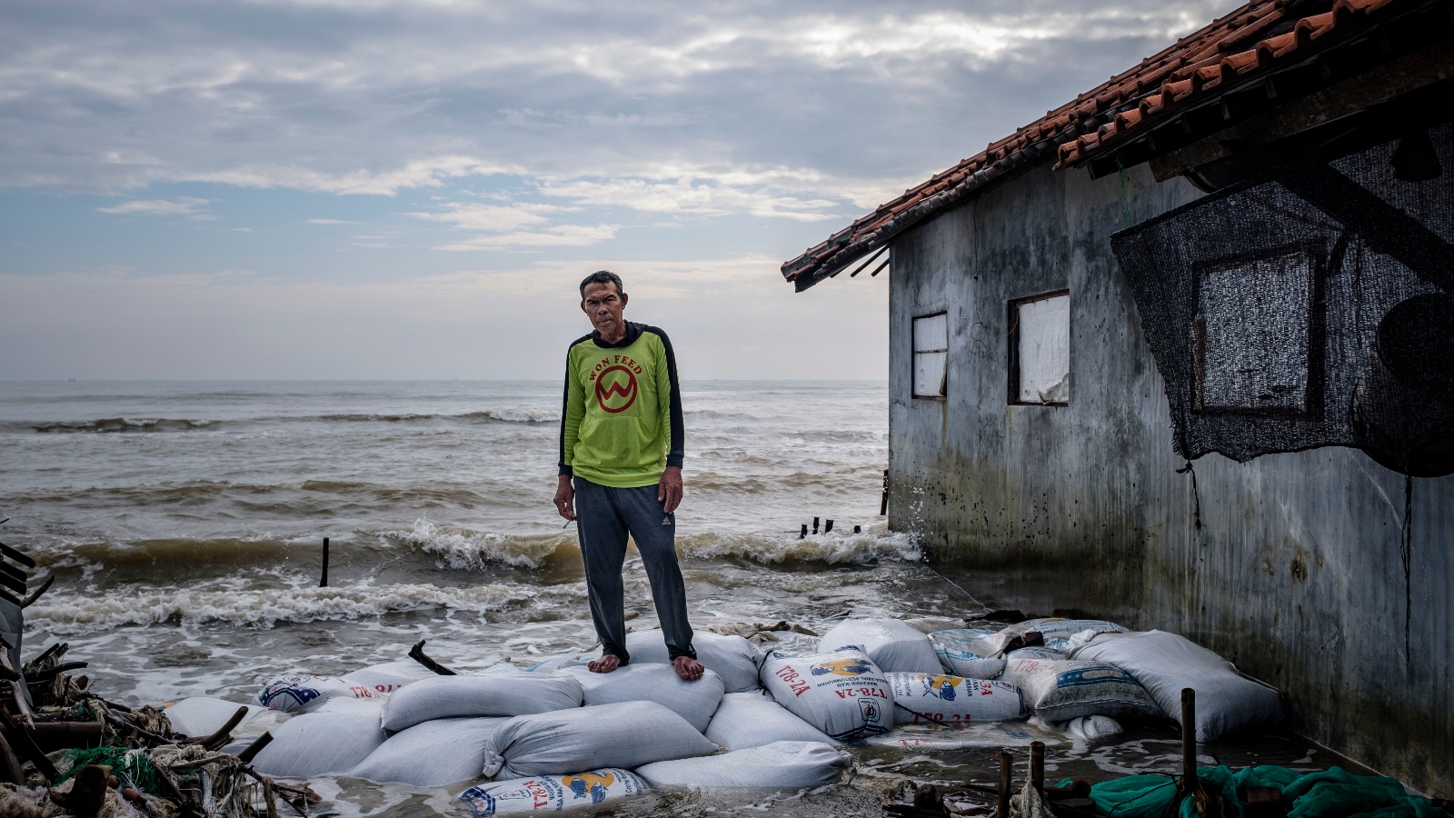
- Java, Indonesia: In the city of Semarang, subsidence is occurring at 20 to 50 times the rate of sea-level rise.
Official Responses and Scientific Reactions
The scientific community has reacted with a mixture of urgency and professional concern. Matt Palmer, a sea-level specialist at the U.K. Met Office’s Hadley Centre, noted that the impacts of climate change have been "systematically underestimated," particularly in the Global South. This sentiment was echoed by Franck Ghomsi of the University of Cape Town, who stated that this new body of research "rewrites the story of coastal vulnerability."
For international bodies like the World Bank and the United Nations, these findings necessitate a total overhaul of disaster risk management and infrastructure funding. Many coastal protection projects currently underway may already be insufficient because they were designed using the old, lower sea-level baselines. Policymakers are now being urged to move beyond global models and invest in local, high-resolution monitoring of both water levels and land elevation.
Broader Impact and Potential Solutions
The analysis of land subsidence offers a rare glimmer of hope amidst the dire data. Unlike global sea-level rise, which is tied to the complex and slow-moving process of global carbon emissions, land subsidence is often a local problem with a local solution.
The case of Tokyo serves as a primary example of successful intervention. After sinking nearly 15 feet in the mid-20th century, the city government implemented strict bans on groundwater pumping. Consequently, land levels stabilized, and the city has remained relatively secure despite its low elevation. Similar efforts are being explored in Shanghai and Bangkok, though the scale of the challenge grows as populations increase.
However, the restoration of river sediment is more difficult. Removing dams or altering levee systems involves complex trade-offs between energy production, flood control for inland areas, and coastal protection. In the Mississippi Delta, the U.S. Army Corps of Engineers has begun diverting sediment-rich water to rebuild protective marshes, a project that is being watched closely by delta managers worldwide.
Fact-Based Analysis of Implications
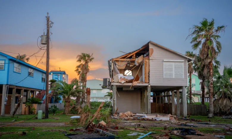
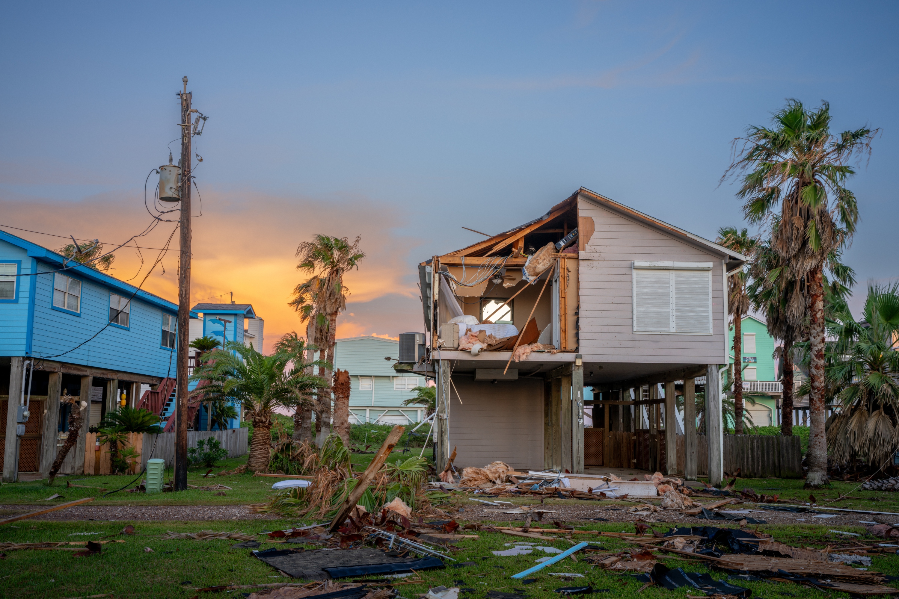
The convergence of higher sea levels and sinking land creates a "multiplier effect" for extreme weather events. When a storm surge or hurricane hits a coast that is already a foot higher than expected and a landmass that has sunk several inches, the resulting inundation is not just incrementally worse—it is exponentially more destructive.
Furthermore, the "saltwater intrusion" caused by these factors is poisoning the groundwater and soil of the world’s "breadbasket" deltas. In the Mekong and Nile deltas, rising salt levels are already reducing crop yields and forcing farmers to abandon land that has been cultivated for millennia. This creates a secondary crisis of food security and internal migration that could destabilize entire regions.
As the scientific community works to integrate these findings into the next generation of climate reports, the message for coastal planners is clear: the "buffer zone" we thought we had is gone. The risk of inundation for tens of millions of people is no longer a distant 21st-century problem; it is a present-day reality that demands immediate and radical adaptation.


